Segmentation plays an important role in computer vision and is used when we need to automate a particular activity.
Computer Vision is basically divided into two parts:- object extraction and image analysis. Different techniques
have been proposed to extract important features from aerial
images. These techniques either use region-based techniques or
edge-based methods. Unfortunately these techniques are not
suitable for the high resolution images now available as they
also provide us with superfluous details which are not useful
for image analysis. As a consequence of this situation, two new
detection techniques are used for the extraction of objects from
high resolution satellite imagery. Within this framework, the
project presented here focuses on edge-based region growing
and edge-based watershed.
|
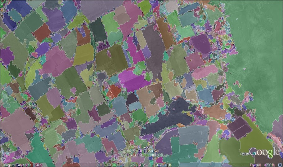
Region growing using DIS maps |
Gray Scale of the Original

|
DIS Map

|
Seed Pixels

|
Mask Image

|
Final Segmented Image

|
|
Watershed segmentation using Edge markers |
Mean Shift Filtering

|
Grayscale
|
Canny Edge Detection

|
Watershed Segmentation using Edge Markers
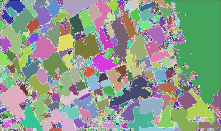
|
Final Segmented Image
|
|
